%20--%3e%3cdefs%3e%3cstyle%3e%20.st0%20{%20fill:%20%23989aa5;%20}%20.st1%20{%20fill:%20%230051bb;%20}%20%3c/style%3e%3c/defs%3e%3cg%3e%3cpolygon%20class='st0'%20points='69.2602%2069.4737%20104.6531%2069.4737%20104.6531%2060.4924%2078.1083%2060.4924%2078.1083%2051.6441%20100.2289%2051.6441%20100.2289%2042.796%2078.1083%2042.796%2078.1083%2033.9477%20104.6531%2033.9477%20104.6531%2025.0574%2069.2602%2025.0574%2069.2602%2069.4737'/%3e%3cpolygon%20class='st0'%20points='160.1877%2054.5947%20138.0841%2025.1016%20129.219%2025.0574%20129.219%2069.3406%20138.0841%2069.3406%20138.0841%2039.8726%20160.1877%2069.3406%20169.0361%2069.3406%20169.0361%2025.0574%20160.1877%2025.0574%20160.1877%2054.5947'/%3e%3crect%20class='st0'%20x='193.602'%20y='25.0574'%20width='8.8483'%20height='44.2832'/%3e%3cpath%20class='st0'%20d='M24.8244,42.8324l-3.541,8.8483h15.2613c-1.8651,5.6716-7.2032,9.7815-13.491,9.7815-7.833,0-14.2056-6.3726-14.2056-14.2058s6.3726-14.2056,14.2056-14.2056c1.8661,0,3.6346.3885,5.2643,1.0519l3.3011-8.2495c-2.6485-1.0617-5.5372-1.6505-8.5654-1.6505C10.3215,24.2026,0,34.5241,0,47.2564s10.3215,23.0541,23.0537,23.0541,23.0541-10.3217,23.0541-23.0541c0-1.5142-.1558-2.9912-.4345-4.424h-20.849Z'/%3e%3cpath%20class='st0'%20d='M416.5159,25.0996l-19.9084-.0422v44.2834h8.8479v-13.2657l11.0605-.0068c8.5164,0,15.4841-6.968,15.4841-15.4845h0c0-8.5164-6.9676-15.4843-15.4841-15.4843ZM423.1841,40.5574c0,3.653-2.9888,6.6415-6.6417,6.6415h0l-11.0869.0186v-13.3017h11.0869c3.653,0,6.6417,2.9886,6.6417,6.6415h0Z'/%3e%3cpath%20class='st0'%20d='M372.0412,40.5838h0c0-8.5164-6.968-15.4843-15.4841-15.4843l-19.9084-.0422v44.2834h8.8479v-13.2657l11.0605-.0068c.2927,0,.5782-.028.8674-.0442l5.3337,13.3261h9.5257l-6.537-16.3462c3.8061-2.828,6.2942-7.3417,6.2942-12.4201ZM363.2253,40.5574c0,3.653-2.9892,6.6415-6.6417,6.6415l-11.0869.0186v-13.3017h11.0869c3.6526,0,6.6417,2.9886,6.6417,6.6415h0Z'/%3e%3cpath%20class='st0'%20d='M290.3093,3.7965l-4.4639,7.7364c9.8109,3.9189,17.6019,11.8447,21.342,21.7439h9.345c-3.9549-13.2573-13.6662-24.0553-26.2231-29.4803Z'/%3e%3c/g%3e%3cg%3e%3cpath%20class='st1'%20d='M253.0626,68.3533l10.0145-17.3576h-10.2284l-5.8264,10.0983c1.6066,2.7405,3.6519,5.1914,6.0403,7.2593Z'/%3e%3cpath%20class='st1'%20d='M318.2553,42.1363h-32.413l-13.9411-24.1626-13.941,24.1626h10.2282l3.7128-6.4351,18.8386,32.6521c2.3883-2.0679,4.4338-4.5188,6.0403-7.2595l-5.8262-10.0981h18.3924c-2.1998,18.7116-18.152,33.2769-37.445,33.2769-20.7916,0-37.7069-16.9149-37.7069-37.7066s16.9153-37.7066,37.7069-37.7066c1.7163,0,3.4054.1176,5.0615.3408l4.711-8.1652c-3.1525-.6759-6.4211-1.035-9.7724-1.035-25.6767,0-46.5664,20.8893-46.5664,46.566s20.8897,46.566,46.5664,46.566,46.566-20.8893,46.566-46.566c0-1.4941-.0736-2.9712-.212-4.4297Z'/%3e%3c/g%3e%3c/svg%3e)
Document your infrastructure once, use it for years
Networks, streets, structures, waterways and buildings: lasting surveys for your tenders, maintenance and master plans.
Reply within 24 business hours
- Accreditation
- CNESST confined space
- Bathymetry
- Single-beam in house, multibeam through partners
- Territory
- Municipalities across Québec
- Availability
- Year-round, including indoor 3D surveys in winter
Outdated infrastructure plans
When the data is out of date, every project starts with an emergency survey. One complete digital survey serves all your mandates.
- Surveys of streets, networks and rights-of-way for design and tenders.
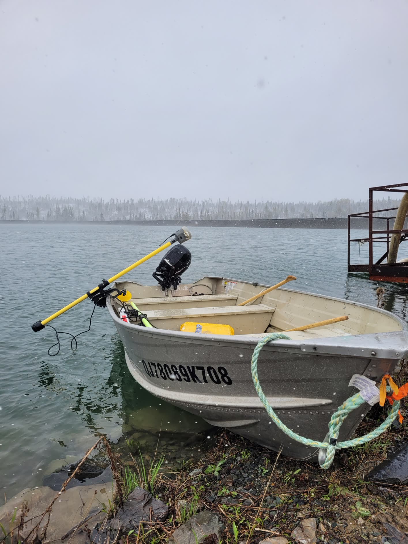
- Single-beam bathymetry of lakes, rivers and shoreline structures, multibeam through partners.
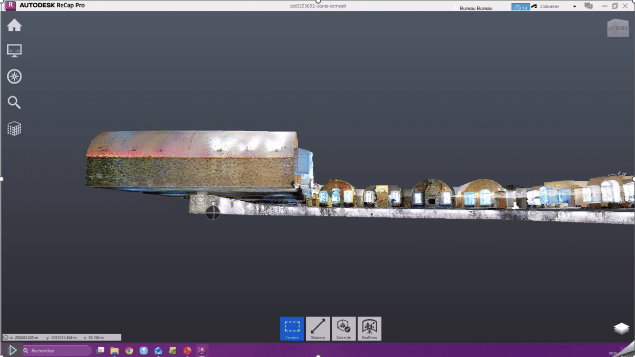
- Digital documentation of municipal buildings and structures via 3D scanning.
- Site supervision: verification of compliance with plans and specifications, with structured reports.
What we deliver
Compatible formats
Verifiable reports
Deliverables handed to the municipality
- 01Georeferenced plans and models compatible with your GIS platforms.
- 02Method and accuracy report, supporting the tender file.
- 03Reusable asset documentation for maintenance and budget planning.
A digital asset, not just another plan
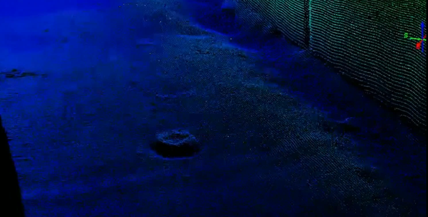
The point cloud stays usable for years: a new section, a new measurement, with no return to the field.
Request a quoteWhat municipalities ask before awarding a mandate
“Does this comply with our tender requirements?”
We regularly handle public mandates: signed and sealed documents, official geodetic reference systems, and certificates and insurance provided with the quote.
“Will our data be usable in our GIS system?”
Yes. Deliverables are georeferenced and provided in formats compatible with your GIS platforms and asset databases. We confirm expected formats before starting, not after.
“Can you work in confined spaces or underwater?”
Yes. Our confined-space interventions are CNESST-accredited, and single-beam bathymetry covers lakes, rivers, water intakes and shoreline structures. Multibeam is delivered through partnerships with specialized firms.
“What does this actually give us?”
Lasting documentation of your assets: pipes, roadways, structures and waterways surveyed once, reusable for design, maintenance and budget planning for years to come.
An infrastructure program to document?
Describe the target area and budget timeline: we propose the most cost-effective method for the accuracy required.