%20--%3e%3cdefs%3e%3cstyle%3e%20.st0%20{%20fill:%20%23989aa5;%20}%20.st1%20{%20fill:%20%230051bb;%20}%20%3c/style%3e%3c/defs%3e%3cg%3e%3cpolygon%20class='st0'%20points='69.2602%2069.4737%20104.6531%2069.4737%20104.6531%2060.4924%2078.1083%2060.4924%2078.1083%2051.6441%20100.2289%2051.6441%20100.2289%2042.796%2078.1083%2042.796%2078.1083%2033.9477%20104.6531%2033.9477%20104.6531%2025.0574%2069.2602%2025.0574%2069.2602%2069.4737'/%3e%3cpolygon%20class='st0'%20points='160.1877%2054.5947%20138.0841%2025.1016%20129.219%2025.0574%20129.219%2069.3406%20138.0841%2069.3406%20138.0841%2039.8726%20160.1877%2069.3406%20169.0361%2069.3406%20169.0361%2025.0574%20160.1877%2025.0574%20160.1877%2054.5947'/%3e%3crect%20class='st0'%20x='193.602'%20y='25.0574'%20width='8.8483'%20height='44.2832'/%3e%3cpath%20class='st0'%20d='M24.8244,42.8324l-3.541,8.8483h15.2613c-1.8651,5.6716-7.2032,9.7815-13.491,9.7815-7.833,0-14.2056-6.3726-14.2056-14.2058s6.3726-14.2056,14.2056-14.2056c1.8661,0,3.6346.3885,5.2643,1.0519l3.3011-8.2495c-2.6485-1.0617-5.5372-1.6505-8.5654-1.6505C10.3215,24.2026,0,34.5241,0,47.2564s10.3215,23.0541,23.0537,23.0541,23.0541-10.3217,23.0541-23.0541c0-1.5142-.1558-2.9912-.4345-4.424h-20.849Z'/%3e%3cpath%20class='st0'%20d='M416.5159,25.0996l-19.9084-.0422v44.2834h8.8479v-13.2657l11.0605-.0068c8.5164,0,15.4841-6.968,15.4841-15.4845h0c0-8.5164-6.9676-15.4843-15.4841-15.4843ZM423.1841,40.5574c0,3.653-2.9888,6.6415-6.6417,6.6415h0l-11.0869.0186v-13.3017h11.0869c3.653,0,6.6417,2.9886,6.6417,6.6415h0Z'/%3e%3cpath%20class='st0'%20d='M372.0412,40.5838h0c0-8.5164-6.968-15.4843-15.4841-15.4843l-19.9084-.0422v44.2834h8.8479v-13.2657l11.0605-.0068c.2927,0,.5782-.028.8674-.0442l5.3337,13.3261h9.5257l-6.537-16.3462c3.8061-2.828,6.2942-7.3417,6.2942-12.4201ZM363.2253,40.5574c0,3.653-2.9892,6.6415-6.6417,6.6415l-11.0869.0186v-13.3017h11.0869c3.6526,0,6.6417,2.9886,6.6417,6.6415h0Z'/%3e%3cpath%20class='st0'%20d='M290.3093,3.7965l-4.4639,7.7364c9.8109,3.9189,17.6019,11.8447,21.342,21.7439h9.345c-3.9549-13.2573-13.6662-24.0553-26.2231-29.4803Z'/%3e%3c/g%3e%3cg%3e%3cpath%20class='st1'%20d='M253.0626,68.3533l10.0145-17.3576h-10.2284l-5.8264,10.0983c1.6066,2.7405,3.6519,5.1914,6.0403,7.2593Z'/%3e%3cpath%20class='st1'%20d='M318.2553,42.1363h-32.413l-13.9411-24.1626-13.941,24.1626h10.2282l3.7128-6.4351,18.8386,32.6521c2.3883-2.0679,4.4338-4.5188,6.0403-7.2595l-5.8262-10.0981h18.3924c-2.1998,18.7116-18.152,33.2769-37.445,33.2769-20.7916,0-37.7069-16.9149-37.7069-37.7066s16.9153-37.7066,37.7069-37.7066c1.7163,0,3.4054.1176,5.0615.3408l4.711-8.1652c-3.1525-.6759-6.4211-1.035-9.7724-1.035-25.6767,0-46.5664,20.8893-46.5664,46.566s20.8897,46.566,46.5664,46.566,46.566-20.8893,46.566-46.566c0-1.4941-.0736-2.9712-.212-4.4297Z'/%3e%3c/g%3e%3c/svg%3e)
NavVis VLX3
Mobile SLAM scanner worn by the technician: capture happens while walking. The result feeds a collaborative digital twin on the Ivion platform, accessible to all stakeholders. No interruption to ongoing operations.
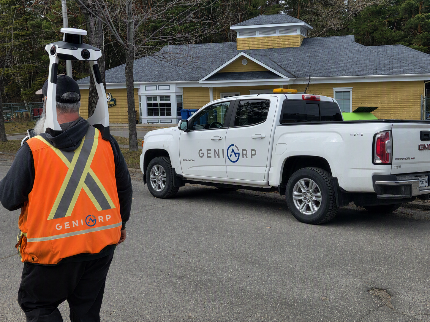
Géniarp continually invests in the fastest 3D capture technologies on the market. Every tool is chosen for a reason: to reduce time on site, increase data density, and eliminate unnecessary return visits.
Mobile SLAM scanning, total station and GNSS in house
A few seconds of real capture: the drone covers in one flight what would take a full day on foot.
Four equipment families, one requirement: bring back usable data on the first visit.
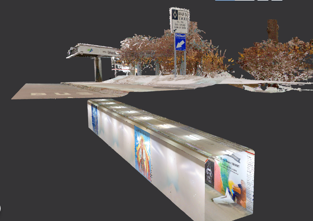
Mobile SLAM scanner worn by the technician: capture happens while walking. The result feeds a collaborative digital twin on the Ivion platform, accessible to all stakeholders. No interruption to ongoing operations.
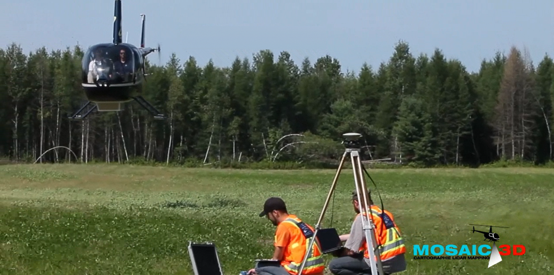
Mounted on aircraft or helicopter, it covers vast areas in a single mission and penetrates vegetation. Delivered through a partnership with specialized firms, coordinated by Géniarp, who remains your single point of contact and integrates the data into your deliverables.
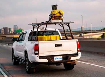
Vehicle-mounted for fast data collection along road corridors and linear infrastructure, with no traffic disruption. Delivered through a partnership with specialized firms, coordinated by Géniarp.
Agility and accuracy for mid-sized projects. Easy access to difficult or hazardous areas, without exposing personnel.
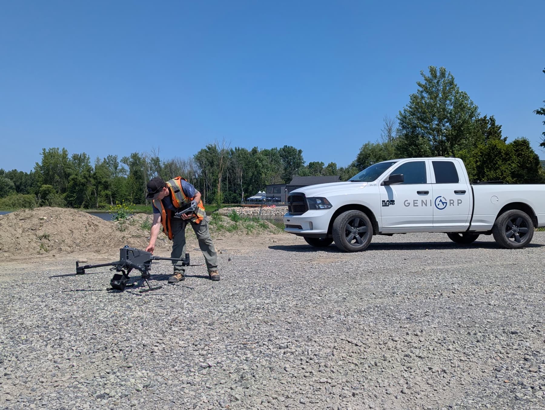
RTK GPS and single-beam echo sounder in house for lakes and rivers. For high-resolution maritime and port projects, the multibeam option is delivered through a partnership with specialized firms, coordinated by Géniarp.
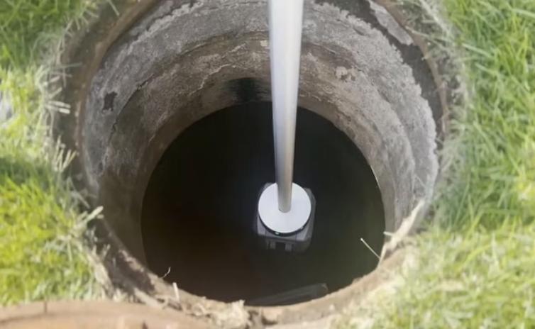
360° capture with no blind spots, for precision scanning of complex spaces such as valve chambers and industrial facilities.
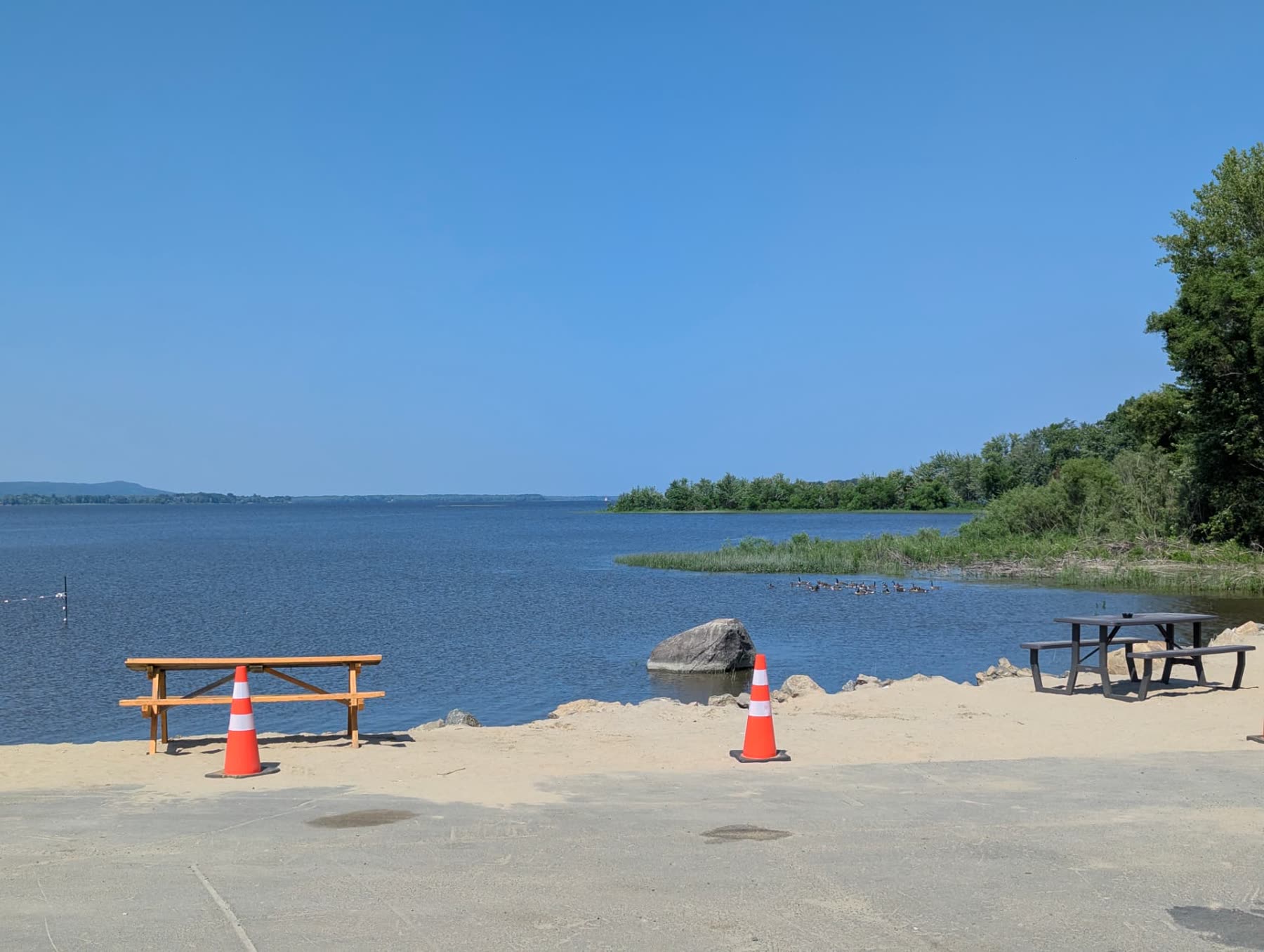
Our pilots hold the required certifications and our missions comply with aviation regulations, in coordination with the relevant authorities.
The point cloud is explored like the site itself: measurements, clearances and connections are checked from a desk, with no confined-space entry.
The call is made when the mandate is booked, based on three criteria. You know what will be deployed before we set foot on site.
A location certificate and a renovation model do not call for the same tolerance. We start from the deliverable, never from the gear on hand.
Confined space, live construction site, port environment or wooded area: access dictates SLAM, drone, sounder or total station.
When your operations cannot stop, mobile scanning captures while walking. When accuracy rules, we take the time the total station needs.
Our projects show how these tools translate into concrete gains: shorter timelines, disputes avoided, job sites never interrupted.
No commitment · Over 35 employees · Across Québec