%20--%3e%3cdefs%3e%3cstyle%3e%20.st0%20{%20fill:%20%23989aa5;%20}%20.st1%20{%20fill:%20%230051bb;%20}%20%3c/style%3e%3c/defs%3e%3cg%3e%3cpolygon%20class='st0'%20points='69.2602%2069.4737%20104.6531%2069.4737%20104.6531%2060.4924%2078.1083%2060.4924%2078.1083%2051.6441%20100.2289%2051.6441%20100.2289%2042.796%2078.1083%2042.796%2078.1083%2033.9477%20104.6531%2033.9477%20104.6531%2025.0574%2069.2602%2025.0574%2069.2602%2069.4737'/%3e%3cpolygon%20class='st0'%20points='160.1877%2054.5947%20138.0841%2025.1016%20129.219%2025.0574%20129.219%2069.3406%20138.0841%2069.3406%20138.0841%2039.8726%20160.1877%2069.3406%20169.0361%2069.3406%20169.0361%2025.0574%20160.1877%2025.0574%20160.1877%2054.5947'/%3e%3crect%20class='st0'%20x='193.602'%20y='25.0574'%20width='8.8483'%20height='44.2832'/%3e%3cpath%20class='st0'%20d='M24.8244,42.8324l-3.541,8.8483h15.2613c-1.8651,5.6716-7.2032,9.7815-13.491,9.7815-7.833,0-14.2056-6.3726-14.2056-14.2058s6.3726-14.2056,14.2056-14.2056c1.8661,0,3.6346.3885,5.2643,1.0519l3.3011-8.2495c-2.6485-1.0617-5.5372-1.6505-8.5654-1.6505C10.3215,24.2026,0,34.5241,0,47.2564s10.3215,23.0541,23.0537,23.0541,23.0541-10.3217,23.0541-23.0541c0-1.5142-.1558-2.9912-.4345-4.424h-20.849Z'/%3e%3cpath%20class='st0'%20d='M416.5159,25.0996l-19.9084-.0422v44.2834h8.8479v-13.2657l11.0605-.0068c8.5164,0,15.4841-6.968,15.4841-15.4845h0c0-8.5164-6.9676-15.4843-15.4841-15.4843ZM423.1841,40.5574c0,3.653-2.9888,6.6415-6.6417,6.6415h0l-11.0869.0186v-13.3017h11.0869c3.653,0,6.6417,2.9886,6.6417,6.6415h0Z'/%3e%3cpath%20class='st0'%20d='M372.0412,40.5838h0c0-8.5164-6.968-15.4843-15.4841-15.4843l-19.9084-.0422v44.2834h8.8479v-13.2657l11.0605-.0068c.2927,0,.5782-.028.8674-.0442l5.3337,13.3261h9.5257l-6.537-16.3462c3.8061-2.828,6.2942-7.3417,6.2942-12.4201ZM363.2253,40.5574c0,3.653-2.9892,6.6415-6.6417,6.6415l-11.0869.0186v-13.3017h11.0869c3.6526,0,6.6417,2.9886,6.6417,6.6415h0Z'/%3e%3cpath%20class='st0'%20d='M290.3093,3.7965l-4.4639,7.7364c9.8109,3.9189,17.6019,11.8447,21.342,21.7439h9.345c-3.9549-13.2573-13.6662-24.0553-26.2231-29.4803Z'/%3e%3c/g%3e%3cg%3e%3cpath%20class='st1'%20d='M253.0626,68.3533l10.0145-17.3576h-10.2284l-5.8264,10.0983c1.6066,2.7405,3.6519,5.1914,6.0403,7.2593Z'/%3e%3cpath%20class='st1'%20d='M318.2553,42.1363h-32.413l-13.9411-24.1626-13.941,24.1626h10.2282l3.7128-6.4351,18.8386,32.6521c2.3883-2.0679,4.4338-4.5188,6.0403-7.2595l-5.8262-10.0981h18.3924c-2.1998,18.7116-18.152,33.2769-37.445,33.2769-20.7916,0-37.7069-16.9149-37.7069-37.7066s16.9153-37.7066,37.7069-37.7066c1.7163,0,3.4054.1176,5.0615.3408l4.711-8.1652c-3.1525-.6759-6.4211-1.035-9.7724-1.035-25.6767,0-46.5664,20.8893-46.5664,46.566s20.8897,46.566,46.5664,46.566,46.566-20.8893,46.566-46.566c0-1.4941-.0736-2.9712-.212-4.4297Z'/%3e%3c/g%3e%3c/svg%3e)
Mapping what lies beneath the surface
Two service levels, from the municipal lake to the port project.
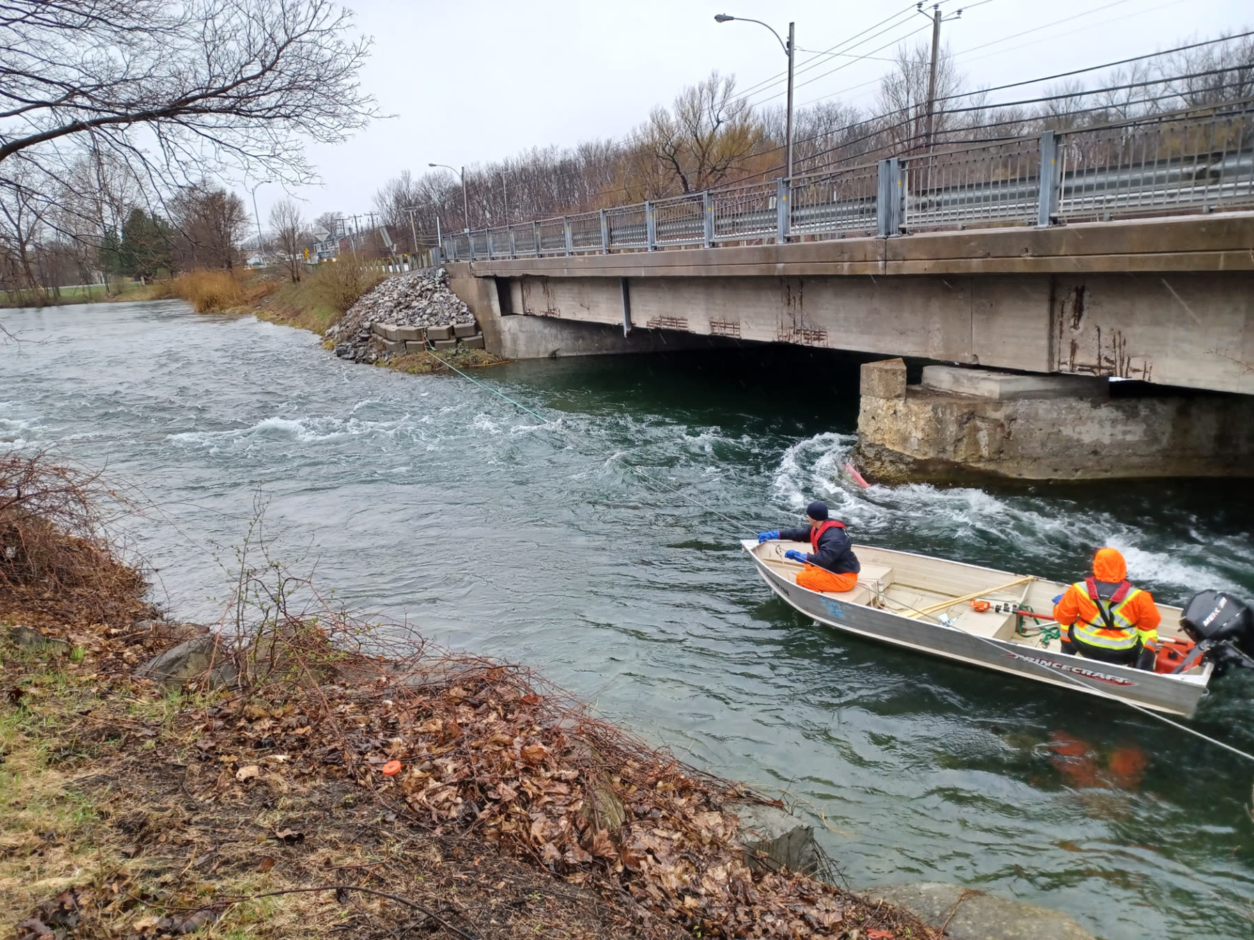
Boats, single-beam echo sounder and RTK positioning in house
- Season
- Open water and through the ice, twelve months a year
- Formats
- DWG, LandXML, XYZ
- Equipment
- Single-beam echo sounder, RTK GPS, vessels in house; multibeam through partnership
- Coverage area
- Lakes, rivers and marine infrastructure across Québec
Standard survey
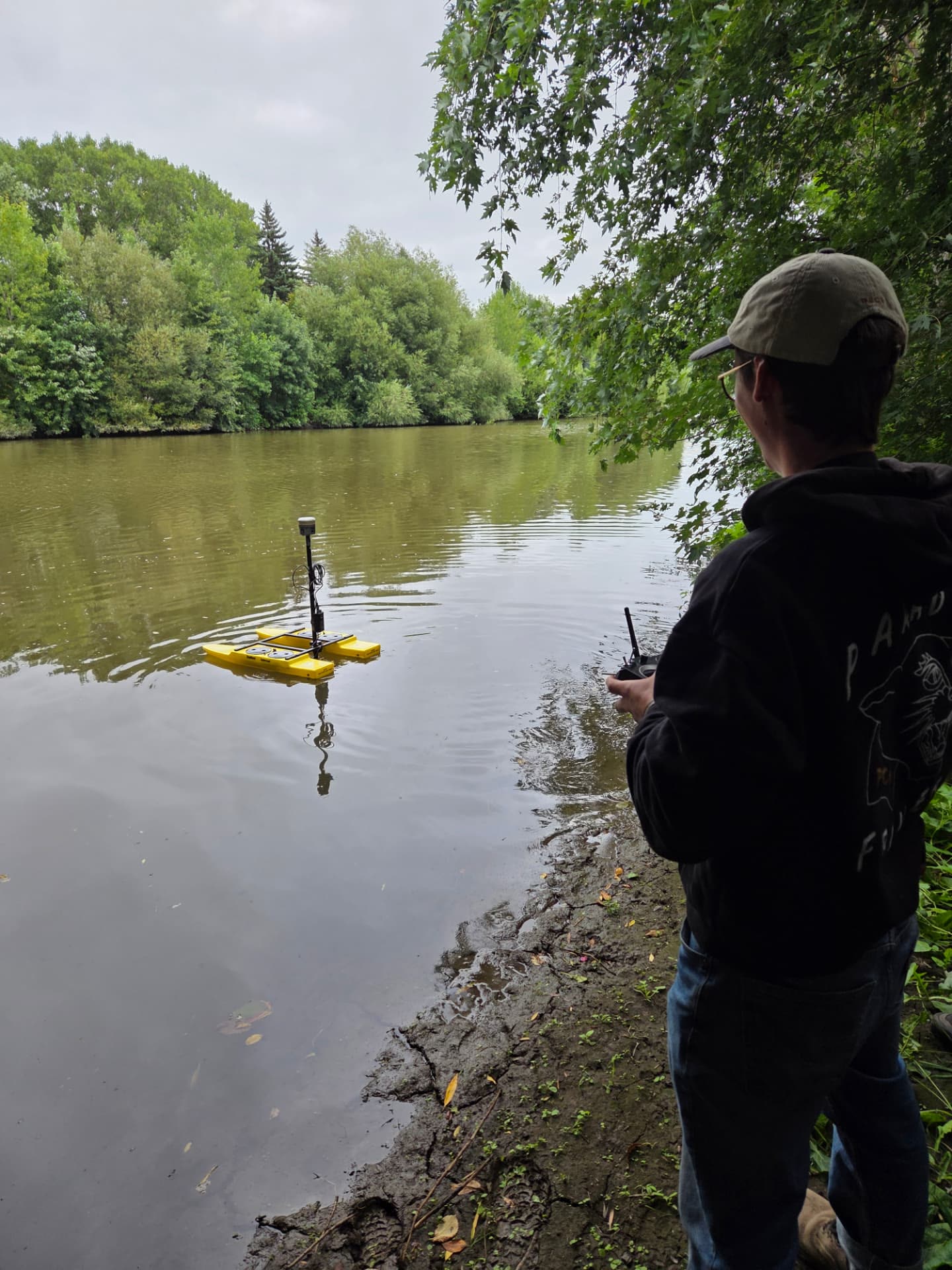
- High-precision RTK GPS positioning.
- Single-beam echo sounder for depth measurement.
- Motorized or remote-controlled vessels depending on water access.
- Suited to lakes, rivers and municipal basins.
Multibeam survey (partnership)
- High-resolution marine mapping for port projects, delivered through a partnership with specialized firms.
- Inspection of ports and submerged structures.
- Dredging planning and monitoring.
- Structural analysis of wharves and marine environmental studies.
- Géniarp coordinates the mandate and integrates the data into your deliverables: a single point of contact.
What you receive
- A clear read of the bottom: depths, sediment build-up, submerged structures.
- Quantified volumes to plan dredging or track its progress.
- Data comparable year over year to monitor how the site evolves.
What you receive
- 01Digital bottom model and bathymetric contours in DWG.
- 02XYZ point set and LandXML file for your calculations.
- 03Survey note: method, date, reference water level and accuracy achieved.
Lakes, rivers and municipalities across Québec
Sedimentation, volumetrics, dredging, seabeds and environmental monitoring.
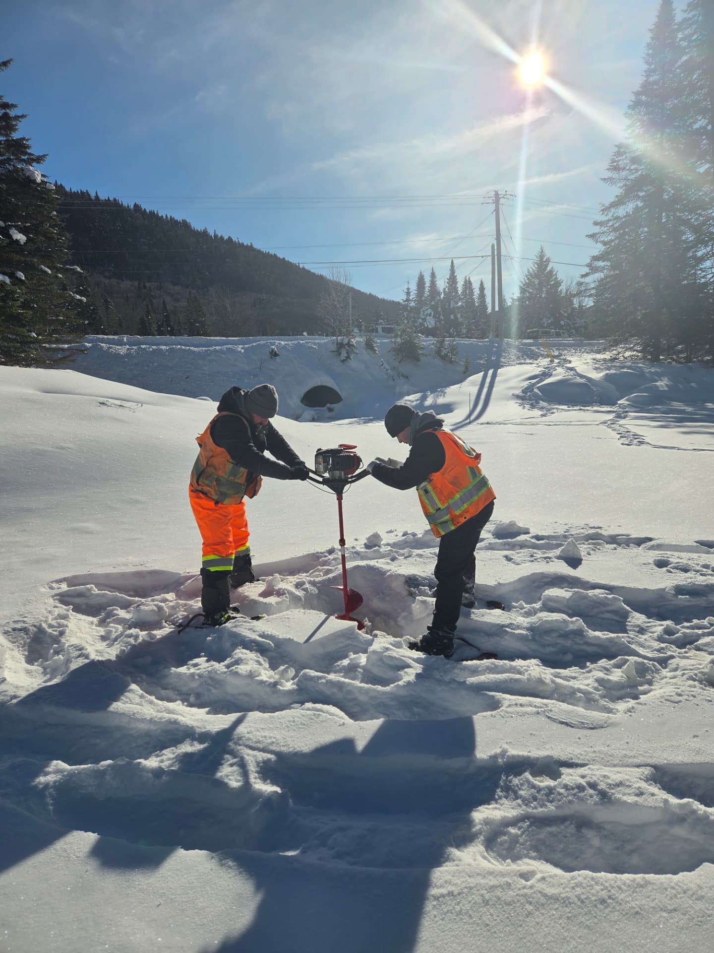
Under the ice too
Winter does not stop surveys: ice drilling, fixed-point sounding and GNSS positioning deliver data comparable to summer work.
Expertise few teams have
Specialized equipment
Partner network
Land integration
How a bathymetric survey unfolds
The same path from one water body to the next: you know what is measured, when, and what you receive.
Scoping the water body
Area to cover, water access, expected depths and required accuracy determine the method and the vessel.
Sounding on water or ice
Echo sounder and RTK GNSS positioning along planned lines, with coverage verified before leaving the site.
Data processing
Water level corrections, sounding cleanup and tie-in to the land survey when both are required.
Deliverables handed over
Digital bottom model, contours and volume calculations, in formats your engineers can use.
Bathymetric surveys: straight answers
What's the difference between single-beam and multibeam surveys?
Single-beam measures depth along sounding lines and suits lakes, rivers and municipal basins; our teams carry it out in house. Multibeam sweeps the entire bottom continuously and produces full coverage, required for port projects, dredging and inspection of submerged structures; it is delivered through a partnership with specialized firms, coordinated by Géniarp, who remains your single point of contact.
In what formats do you deliver bathymetric data?
Digital terrain model, bathymetric contours and point cloud, in DWG, LandXML or XYZ formats depending on your design or environmental monitoring needs.
What access to the body of water is required?
A boat launch for a motorized or remote-controlled vessel is sufficient in most cases. We assess access when scoping the mandate.
Can you track sedimentation over time?
Yes, by comparing repeated surveys of the same body of water, we produce volumetric tracking useful for dredging planning or municipal basin management.
What our clients say
“We have been working with Geniarp for years. Professional and fast service for our topographic surveys for various civil engineering and water treatment projects.”
A water body to map?
Tell us the site, estimated depth and access: we confirm feasibility before quoting the mandate.