%20--%3e%3cdefs%3e%3cstyle%3e%20.st0%20{%20fill:%20%23989aa5;%20}%20.st1%20{%20fill:%20%230051bb;%20}%20%3c/style%3e%3c/defs%3e%3cg%3e%3cpolygon%20class='st0'%20points='69.2602%2069.4737%20104.6531%2069.4737%20104.6531%2060.4924%2078.1083%2060.4924%2078.1083%2051.6441%20100.2289%2051.6441%20100.2289%2042.796%2078.1083%2042.796%2078.1083%2033.9477%20104.6531%2033.9477%20104.6531%2025.0574%2069.2602%2025.0574%2069.2602%2069.4737'/%3e%3cpolygon%20class='st0'%20points='160.1877%2054.5947%20138.0841%2025.1016%20129.219%2025.0574%20129.219%2069.3406%20138.0841%2069.3406%20138.0841%2039.8726%20160.1877%2069.3406%20169.0361%2069.3406%20169.0361%2025.0574%20160.1877%2025.0574%20160.1877%2054.5947'/%3e%3crect%20class='st0'%20x='193.602'%20y='25.0574'%20width='8.8483'%20height='44.2832'/%3e%3cpath%20class='st0'%20d='M24.8244,42.8324l-3.541,8.8483h15.2613c-1.8651,5.6716-7.2032,9.7815-13.491,9.7815-7.833,0-14.2056-6.3726-14.2056-14.2058s6.3726-14.2056,14.2056-14.2056c1.8661,0,3.6346.3885,5.2643,1.0519l3.3011-8.2495c-2.6485-1.0617-5.5372-1.6505-8.5654-1.6505C10.3215,24.2026,0,34.5241,0,47.2564s10.3215,23.0541,23.0537,23.0541,23.0541-10.3217,23.0541-23.0541c0-1.5142-.1558-2.9912-.4345-4.424h-20.849Z'/%3e%3cpath%20class='st0'%20d='M416.5159,25.0996l-19.9084-.0422v44.2834h8.8479v-13.2657l11.0605-.0068c8.5164,0,15.4841-6.968,15.4841-15.4845h0c0-8.5164-6.9676-15.4843-15.4841-15.4843ZM423.1841,40.5574c0,3.653-2.9888,6.6415-6.6417,6.6415h0l-11.0869.0186v-13.3017h11.0869c3.653,0,6.6417,2.9886,6.6417,6.6415h0Z'/%3e%3cpath%20class='st0'%20d='M372.0412,40.5838h0c0-8.5164-6.968-15.4843-15.4841-15.4843l-19.9084-.0422v44.2834h8.8479v-13.2657l11.0605-.0068c.2927,0,.5782-.028.8674-.0442l5.3337,13.3261h9.5257l-6.537-16.3462c3.8061-2.828,6.2942-7.3417,6.2942-12.4201ZM363.2253,40.5574c0,3.653-2.9892,6.6415-6.6417,6.6415l-11.0869.0186v-13.3017h11.0869c3.6526,0,6.6417,2.9886,6.6417,6.6415h0Z'/%3e%3cpath%20class='st0'%20d='M290.3093,3.7965l-4.4639,7.7364c9.8109,3.9189,17.6019,11.8447,21.342,21.7439h9.345c-3.9549-13.2573-13.6662-24.0553-26.2231-29.4803Z'/%3e%3c/g%3e%3cg%3e%3cpath%20class='st1'%20d='M253.0626,68.3533l10.0145-17.3576h-10.2284l-5.8264,10.0983c1.6066,2.7405,3.6519,5.1914,6.0403,7.2593Z'/%3e%3cpath%20class='st1'%20d='M318.2553,42.1363h-32.413l-13.9411-24.1626-13.941,24.1626h10.2282l3.7128-6.4351,18.8386,32.6521c2.3883-2.0679,4.4338-4.5188,6.0403-7.2595l-5.8262-10.0981h18.3924c-2.1998,18.7116-18.152,33.2769-37.445,33.2769-20.7916,0-37.7069-16.9149-37.7069-37.7066s16.9153-37.7066,37.7069-37.7066c1.7163,0,3.4054.1176,5.0615.3408l4.711-8.1652c-3.1525-.6759-6.4211-1.035-9.7724-1.035-25.6767,0-46.5664,20.8893-46.5664,46.566s20.8897,46.566,46.5664,46.566,46.566-20.8893,46.566-46.566c0-1.4941-.0736-2.9712-.212-4.4297Z'/%3e%3c/g%3e%3c/svg%3e)
Existing conditions, measured the way you'll draw them
BOMA measurement, interior plans, existing-conditions surveys and point clouds: reliable starting data for your renovation, fit-out and extension projects.
Reply within 24 business hours
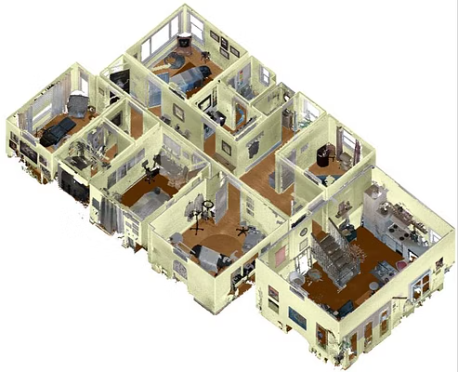
- Measurement
- Certificate compliant with the BOMA standard
- Delivery formats
- RCP/RCS, E57, LAS, DWG
- Compatibility
- Revit, AutoCAD, SketchUp
- Territory
- Anywhere in Québec
What we measure for your projects
From a measurement certificate to a full survey of a heritage building: the same rigour, the same focus on deliverables you can use directly.
- Measurement certificate and rentable-area calculation to the BOMA standard, for commercial, industrial and multi-residential buildings.
- Interior and fit-out plans: floor plans, sections, elevations and ceilings, ready for design.
- Existing-conditions surveys before renovation or extension, inside and outside the building.
- Surveys by 3D scanner and, through partnerships, by airborne or mobile LiDAR for large sites.
What you receive
Design-ready drawings
Georeferenced point clouds
BOMA measurement certificate
One team, from field to file
Files delivered to your designers
- 01Measurement certificate and rentable-area calculation compliant with BOMA.
- 02Interior and fit-out plans in DWG, following your templates.
- 03Georeferenced point cloud, raw and processed (RCP/RCS, E57, LAS).
- 04Shared access on the Ivion collaborative platform for the whole team.
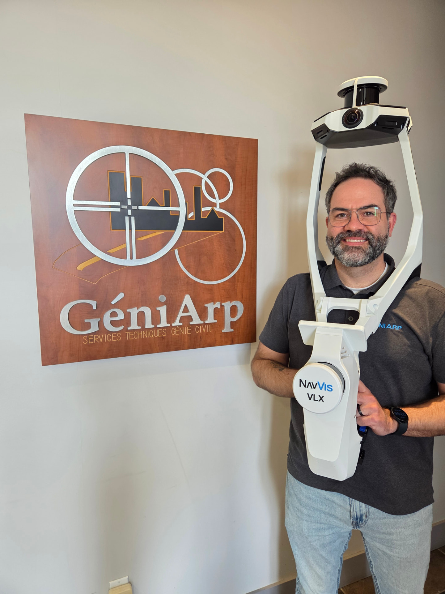
A complete survey beats a second trip
Give us the building address and your schedule: we confirm the method, the achievable accuracy and the delivery date.
Request a quoteQuestions architects ask
“Can you measure a building to the BOMA standard?”
Yes. We produce the measurement certificate and rentable-area calculation in accordance with the BOMA standard for commercial, industrial and multi-residential buildings, with supporting floor plans.
“Do your files open in Revit?”
Yes. Point clouds are delivered in standard formats (RCP/RCS, E57, LAS) and CAD drawings in DWG, following your templates and layer conventions. Tell us yours at the quote stage.
“We need to document an existing building before designing. Where do we start?”
With a complete existing-conditions survey: 3D scanning inside, ground survey outside. You receive a georeferenced point cloud and the drawings you need — sections, elevations, floor plans.
“What if we need a section that wasn't planned?”
With a point cloud, the data is already there: we extract the missing section or elevation without going back to the site. That is what avoids addenda and return trips.
A building to measure? Let's talk about the starting survey
Describe the mandate, attach your preliminary drawings and tell us when you need the data.